Our plan safely connects communities and promotes healthy and green alternatives.
Equity
Safer Illinois would provide a desperately needed safe route for Bayview-Hunters Point and other southeastern neighborhoods to get downtown and connect to existing protected routes to the Mission and other western neighborhoods. The Bayview-Hunters Point Community Based Transportation Plan identified “connecting [Bayview-Hunters Point] to the rest of San Francisco” as a priority for bike improvements, as well as “creating low-stress neighborhood routes for north-south streets so people on bikes can avoid Third Street.” Safer Illinois would provide these benefits to the community, enabling low-cost, healthy, reliable, and fast transport to get to work, school, and recreation destinations.
With the planned closure of the Third Street bridge over Islais Creek for renovations—which will close the T-Third, reroute traffic, and lengthen commute times—Safer Illinois will be even more important as a viable alternative to transit and private cars.

Safety
In addition to reducing collisions along the route, Safer Illinois would draw bikes and scooters off the parallel stretch of Third Street, which is part of the high-injury network. While Illinois itself might not currently be part of the high-injury network, many supporters have shared their personal horror stories of trips to the ER, stitches to severed lips, surgeries, broken bones, and gnarly bruises. Safer Illinois is clearly needed for San Francisco to achieve its commitment to Vision Zero.
The planned closure of the Third Street bridge over Islais Creek raises additional safety concerns. If it absorbed all the Third St traffic during the closure, Illinois St traffic volumes would be three to five times higher than current levels. DPW must mitigate the impacts of the planned closure by ensuring safe passage for bikes and pedestrians. Without Safer Illinois, bike riders would be at higher risk due to higher traffic volumes and impatient drivers.
Recreation
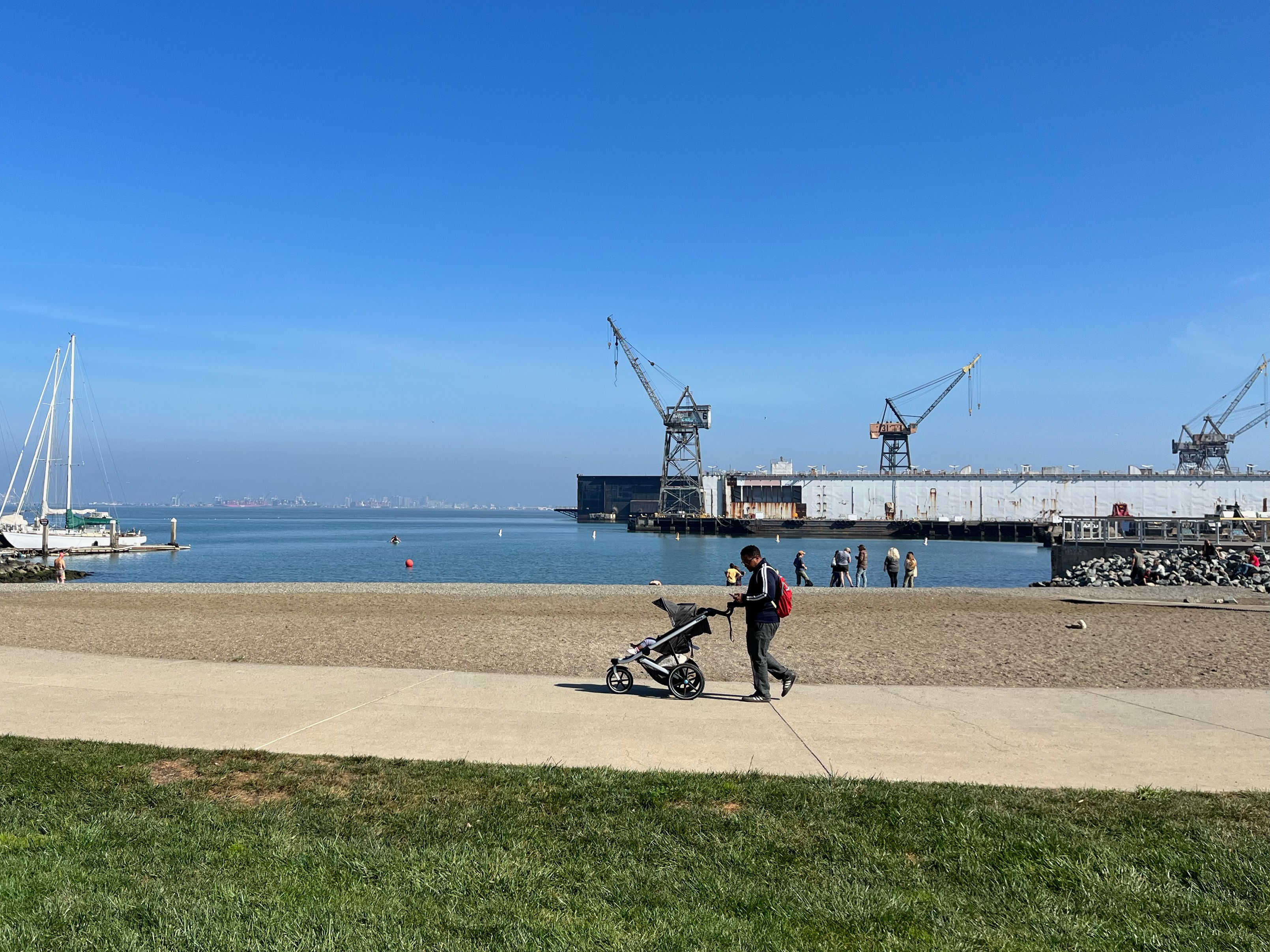
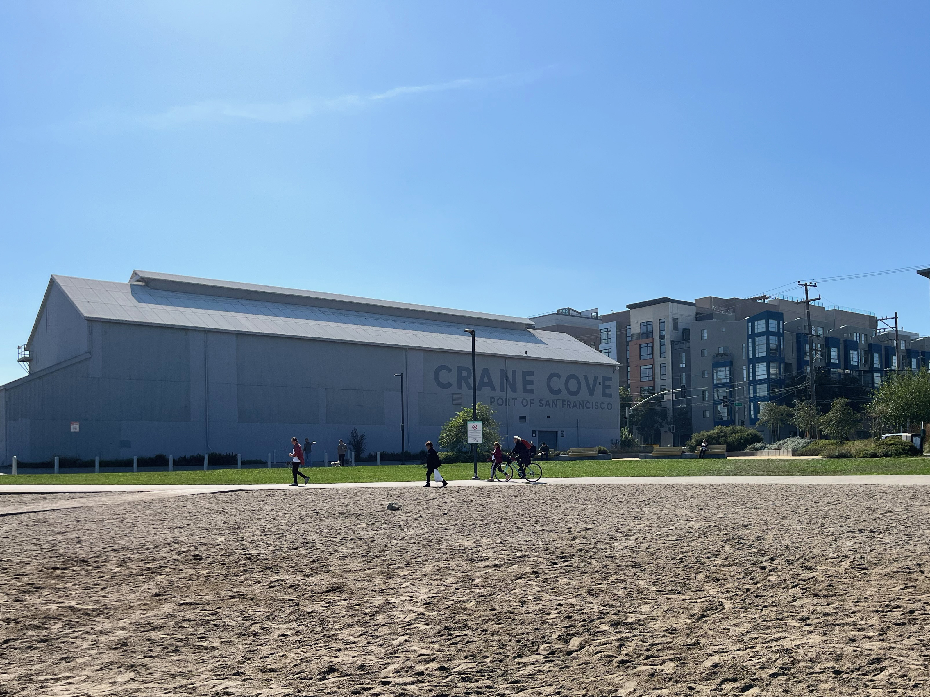
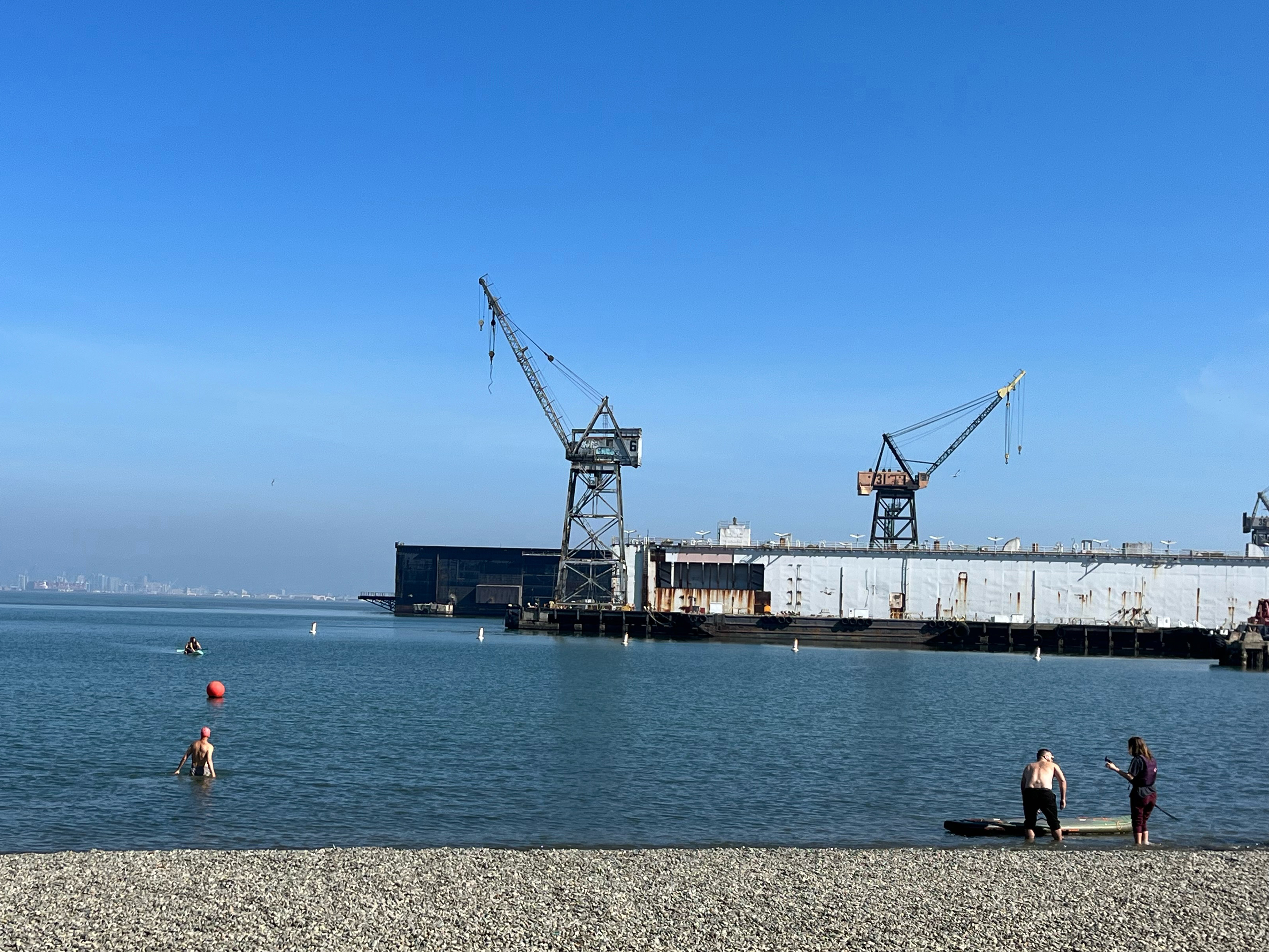
As the designated route of the Bay Trail and the Blue Greenway, Illinois St is a 1.1-mile gap in safe infrastructure that would otherwise connect 25 waterfront parks and recreational facilities and link 6 miles of high-quality, protected paths along the waterfront. Safer Illinois would enable safe bicycle access to the newest parks on the east side, including the newly-opened China Basin Park, the soon-to-open Bayfront Park across from Chase Center, the much-loved Crane Cove Park, which opened in 2020, and the highly anticipated revamped India Basin Shoreline Park, which is scheduled to open in Fall 2024. Safer Illinois would be a bikeway befitting the Blue Greenway designation.
Health & Environment
As it is widely supported without any active opposition, Safer Illinois could be a quick win, an excellent showpiece for the San Francisco Biking and Rolling Plan, and a healthy, vibrant San Francisco. By bridging a critical infrastructure gap, Safer Illinois will get people out of their cars and onto the healthiest and cleanest mode of transport available. And, yes, we do need to pick up the pace to meet San Francisco’s Climate Action Plan, requiring that “by 2030, 80% of all trips are low-carbon (e.g., transit, walking and biking).”